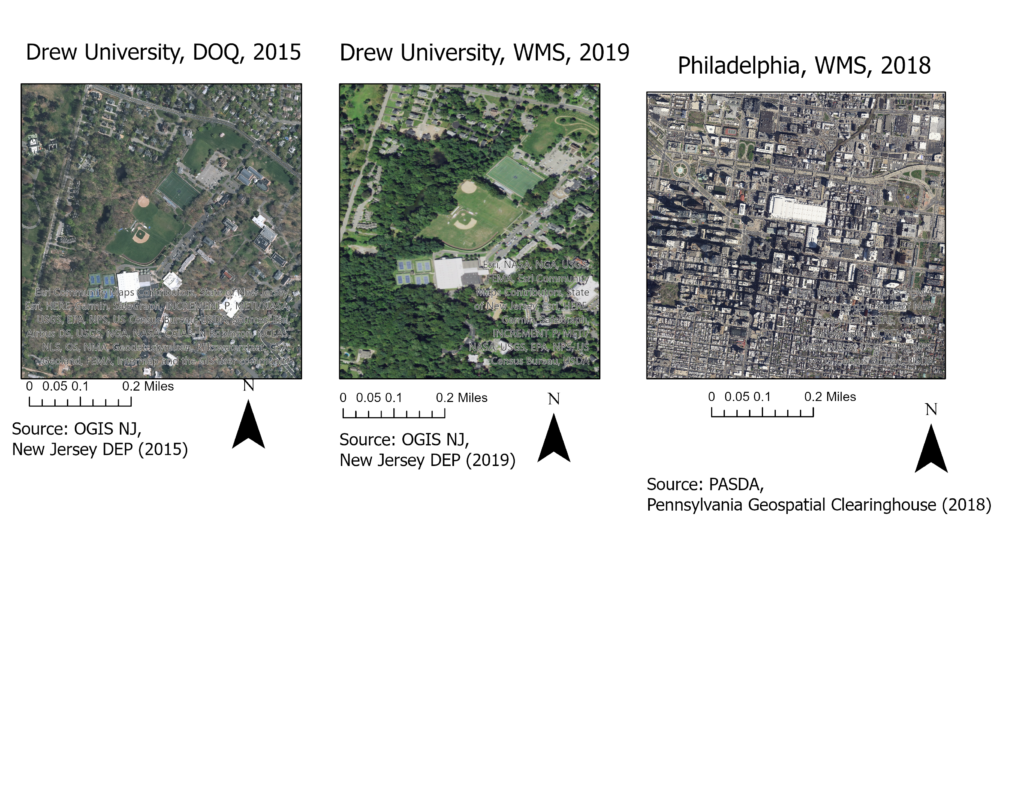
For this project, I collected data from spatial data warehouses kept by two U.S. states: New Jersey and Pennsylvania. These warehouses of data allow us to pull data from any year images were taken, and this can be used to compare how an area changes over time. There are two ways to obtain this data: Digital Orthophoto Quadrangles (DOQs), and Web Mapping Services (WMS’s). Images are most often obtained as tiles of data that are then applied to a GIS map. Two of the images above are of Drew University, the DOQ being taken in 2015 and the WMS being taken in 2019. The third image is of Philadelphia that was taken in 2018 and obtained using a Pennsylvania WMS.